
Getty Images/C Borland/PhotoLink
209.0 miles:
5 hours,
0 minutes
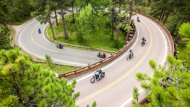
This picturesque route winds through South Dakota's Black Hills, taking you from one of America's best-known landmarks, Mount Rushmore, past granite spires and into historic mining towns nestled in valleys thick with Ponderosa pine. The area packs so much scenery into a small area that it's become a mecca for motorcyclists and anyone else who loves the outdoors.

jameslee999/iStockphoto.com
1
Mount Rushmore National Memorial to Spearfish
78.3 miles:
1 hours,
35 minutes
Leaving Mount Rushmore National Memorial, you'll sample a short portion of Peter Norbeck Scenic Byway, which twists and turns through some of the Black Hills' prettiest scenery. Passing through Rapid City, South Dakota's second largest city, the route then skirts the edge of the Black Hills, traversing mostly grassy, rolling terrain on the way to Spearfish.
Courtesy of South Dakota Department of Tourism
2
Spearfish to Deadwood
28.1 miles:
46 minutes
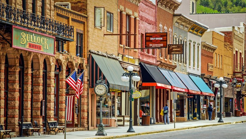
The prairie abruptly yields to tall pines and yellowish limestone cliffs as you enter the Black Hills from the north via Spearfish Canyon Scenic Byway. Trails lead from pullouts along the byway to pretty waterfalls tumbling over the cliffs. Heading east toward Lead, the route ascends heavily forested hills to the historic gold rush towns of Lead and Deadwood.
Courtesy of South Dakota Department of Tourism
3
Deadwood to Jewel Cave National Monument
75.1 miles:
1 hours,
55 minutes
The scenery along US 385 is pretty—pine trees and a view of Pactola Reservoir—but not especially dramatic as you travel south toward Custer and then west to Jewel Cave National Monument. If time permits, a side trip along Needles Highway (SR 87 south of Hill City) into Custer State Park offers a spectacular jaunt beneath granite spires on a narrow, two-lane road.

