 For the second year in a row, we’ve opted to celebrate the accomplishments of leaders in our field at the Lidar Leader Awards, a joint initiative of LIDAR Magazine and the organizers of the International LiDAR Mapping Forum (ILMF). This year’s ceremony was held on January 29th, 2019 in Denver—we’ve highlighted winners and many finalists below. The official announcement of winners is here. Five categories were offered this year:
Outstanding Personal Achievement in Lidar
Outstanding Team Achievement in Lidar (2-99 members)
Outstanding Enterprise Achievement in Lidar (groups of 100+)
Outstanding Innovation in Lidar (New for 2019)
This category was created to honor recent projects or products that appear to be ground-breaking.
Outstanding University Achievement in Lidar (New for 2019)
This category is open to all universities, students and teams within the university, who must demonstrate an exceptional achievement within the realm of lidar technology.
Editor’s note: The text that follows has been excerpted from original nominations and in no way defines the views or opinions of the award committee, the organizers of ILMF or LIDAR Magazine. Some text has been edited for clarity and length.
Outstanding Personal Achievement
 WINNER of the 2019 LIDAR Leader Award for Personal Achievement:
Karl Heidemann, Physical Scientist, USGS (Retired)
Hans (Karl) Heidemann led the development of lidar standards and specifications within USGS and served as their representative on various inter-agency and national and international lidar commissions. He provided technical expertise on lidar contracting and quality assurance for the National Geospatial Program (NGP) and the 3D Elevation Program (3DEP). He authored the USGS Lidar Base Specifications (LBS) published in 2012 and revised in 2014 and 2018. This seminal document provided the first lidar guidance centered on the primacy of the point cloud as source data, opening the way for consistent use of lidar data for diverse applications and establishing data handling practices that substantially improve capacity for cross-collection, multi-vendor, multi-instrument data analysis. Beyond its use for the NGP and 3DEP, the LBS has become the base of countless lidar collection contracts nationally and internationally. The release of the LBS v1.3 was Karl’s last official act prior to his retirement from USGS in 2018. Joining the USGS at the EROS Center in 2008, Mr. Heidemann revamped lidar data ingest and distribution for the Center for Lidar Information Coordination and Knowledge (CLICK) portal and supported numerous collection and scientific efforts including a national collection for El Salvador. He played a leading role in the integration of lidar derived data into the National Elevation Dataset (NED) and developed the standards for the now ubiquitous process of hydro-flattening topographic DEMs for the 3DEP. He has been a leading advocate of a USGS migration from traditional quad-based tiling to a CONUS-based Cartesian system more suitable for seamless lidar data management. In 2014, Mr. Heidemann was a co-author of the ASPRS Positional Accuracy Standards for Digital Geospatial Data and established the ASPRS standard for the number of lidar QA/QC checkpoints in vegetated and non-vegetated terrain. He is a long-standing and active member of ASPRS, currently serving as the Chair of the Lidar Certification Review Committee. In private industry, he developed lidar data calibration, automated classifications, surface generation, and data management procedures widely used today, and he has conducted workshops and classes in lidar for both the public and private sectors.

 Personal Finalist, Karen Schuckman, Assistant Teaching Professor, Department of Geography, Penn State
For the past two decades, Karen Schuckman has made numerous noteworthy contributions and has sustained forward-thinking leadership in advancing the mainstreaming of lidar technologies in the geospatial/ mapping community. Her activities range from leading the lidar data acquisition team in the first statewide lidar mapping program in North Carolina, to initiating formation of the lidar Division within ASPRS, coordinating early standards development efforts, and now teaching aspiring and mid-career professionals for Penn State’s Online Geospatial Education Programs. Karen has undertaken several leadership roles, such as the North Carolina FEMA floodplain mapping, where she was the principal project manager for the EarthData team, including a team of developers working with survey and engineering partners. Their work became the model that stimulated development of standards, development of commercial software, and led to broad acceptance of lidar as a mainstream mapping tool. Karen has been an active participant in ILMF since its inception provided essential leadership to bring together key manufacturers, government experts and policymakers, and early users. Her efforts supported the growth of ILMF as a respected gathering of private practitioners and government agencies, paving the way for transferring the emerging lidar technology into operational practice.
Karen transitioned her energies to teaching when she joined the Department of Geography faculty at Penn State in 2007. At that time, the Online Geospatial Education Program focused on GIS and lacked content in the areas of photogrammetry and remote sensing. Over the 12 years she has been at Penn State, Karen has personally taught over 1,000 students and has spearheaded the evolution of the program to include a Graduate Certificate in Remote Sensing and Earth Observation launched in 2017.
Outstanding Team Achievement
WINNER of the 2019 LIDAR Leader Award for Team Achievement:
Joint Airborne Lidar Bathymetry Technical Center of Expertise (JALBTCX) Team
 The Joint Airborne Lidar Bathymetry Technical Center of Expertise (JALBTCX) team leads operations, research and development of airborne lidar bathymetry and complementary technologies for the U.S. government. Formed in 1998, JALBTCX supports the National Coastal Mapping Program (NCMP) requirements of the U.S. Army Corps of Engineers (USACE), and the Airborne Coastal Survey mapping requirements for the Naval Oceanographic Office. The NCMP’s high-resolution elevation and imagery data is collected along U.S. shorelines on a recurring basis.
JALBTCX Director Jennifer Wozencraft, a research physical scientist in the USACE Engineer Research and Development Center’s Coastal and Hydraulics Laboratory, heads a team of engineers, scientists, hydrographers and technicians, including Lauren Dunkin, Joseph Harwood, Nicholas Johnson, Chris Macon, Molly Reif and Charlene Sylvester. This team led the development of the Coastal Zone Mapping and Imaging Lidar (CZMIL), which acquires airborne bathymetric and topographic lidar and digital and hyperspectral imagery in a single airborne platform. The JALBTCX team has acquired airborne lidar bathymetry multiple times along the conterminous United States coastline (including the Great Lakes) as well as in Alaska, Hawaii and the U.S. territories. Additionally, the team acquired emergency response data following natural disasters such as Katrina, Sandy, Matthew, Irma, Maria and Florence. The data is used to analyze beach and dune response to storms, assess shoreline changes and support coastal resiliency.
Publicly available through the National Oceanic and Atmospheric Administration’s Digital Coast Partnership, the data also can be used for engineering purposes.
By supporting research and development and leveraging work with private industry, the government and academia, the JALBTCX team continues to advance airborne lidar bathymetry, coastal mapping, charting technology and data applications to the benefit of all involved.
Topographic Laser Ranging and Scanning”, 2nd Edition
Team finalist, Topographic Laser Ranging and Scanning Team—Drs. Jie Shan & Charles Toth
The publication “Topographic Laser Ranging and Scanning” is a seminal reference book for anyone seriously involved in the lidar industry. There are few comprehensive reference books on this subject, and none that compares in overall content and technical depth. This book by Shan and Toth is now in 2nd edition. It represents a culmination
of decades of experience in lidar and mapping for these two prominent individuals.
Outstanding Enterprise Achievement

 WINNER of the 2019 LIDAR Leader Award for Enterprise Achievement: Woolpert
Woolpert has provided a high-level of contributions to the lidar industry in service, management and development since the technology was introduced. An early adopter pioneer of lidar technologies, Woolpert has set many industry precedents. Examples of their work with federal agencies, programs and applications include:
- USGS: Woolpert has acquired and processed over 350,000 square miles of lidar data in support of 3DEP at dozens of locations both CONUS and OCONUS, including statewide programs; and evaluated lidar technologies for 3DEP.
- BuckEye: Woolpert evaluated and improved data workflow, and led the design, integration and testing of its next-generation airborne sensor.
- USACE/JALBTCX: Woolpert is supporting bathymetric and topographic lidar acquisition at CONUS and OCONUS locations and with simultaneous airborne operations to vastly increase data acquisition rates.
- DARPA: Woolpert performed data fusion of imagery, airborne and mobile lidar data acquired by Woolpert for the defense agency. The imagery was used to colorize the blended lidar point cloud. The fused data set was the basis for one of the first semi-automated feature extraction projects.
Woolpert also:
- Acquired and processed lidar data to support security for 2 presidential inaugurations.
- Acquired and processed lidar data to support the 133 Urban Area Elevation Data program.
- Acquires and processes airborne, mobile and terrestrial lidar data for many DOTs.
- Rapidly acquires and processes lidar data for federal agencies for post-storm emergency response.
- Conducted the first large lidar projects in Florida.
- Conducted the first inland riverine topographic-bathymetric project in Washington (2004).
- Conducted the first countywide lidar with topographic mapping project in the nation in Alabama (2005).
- Developed and conducted the first statewide lidar program of its kind in Ohio (2006).
- Acquired and processed lidar data in support of the Panama Canal expansion (2007).
- Conducted the largest mobile mapping project at the time, collecting over 3,500 linear miles in Indianapolis (2010).
- Developed a novel SPL and side-stepping RGB camera co-collection mapping system for the Army in 2013, meeting wide-area mapping requirements and penetrating dense vegetative canopy.
- Was contracted by the USGS to evaluate Geiger mode and SPL for 3DEP, leading to USGS considering these viable.
- Conducted the largest commercial SPL acquisition in North America in 2017.
- Continues to develop automated tools to extract intelligent data from lidar point clouds.
- Woolpert’s Dr. Qassim Abdullah, Jeff Lovin and Layton Hobbs served on ILMF and ASPRS advisory boards. The firm owns and operates a fleet of aircraft, vehicles and lidar sensors, and trains clients to make better use of lidar data.
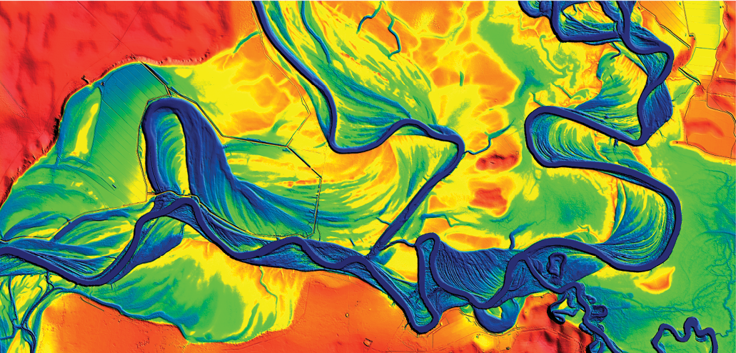
A section of the Murray River as featured in ELVIS.
Enterprise finalist, Geoscience Australia—ELVIS Elevation Infrastructure
Geoscience Australia has developed an online shared infrastructure called ELVIS elevation (Elevation.FSDF.org.au) to access and discover lidar and DEM datasets across Australia. A national collaboration between Geoscience Australia, NSW Government Spatial Services, Tasmanian Government Department of Primary Industries, Water and Environment, Queensland Government Department of Natural Resources, Mines and Energy and ACT Government enables users to easily discover and freely access Australia’s highly valuable, open lidar and DEM data from various sources in one location. ELVIS enables open data holdings to be uploaded and managed in a federated infrastructure by each state and territory government custodian of these elevation products. Through this highly successful collaboration, the volume of elevation data available through ELVIS has risen significantly since late 2016 from 3TB to 400TB today. The key to achieving this growth has been in GA’s extensive engagement with government jurisdictions around the country and illustration of the mutual benefits of a collaborative, coordinated, automated and shared data distribution framework. A positive feedback loop developed once the initial state and territory custodians began engaging and uploading their data for user discovery. Broad public interest in the data began growing exponentially, causing more custodians to engage and making ever larger volumes of data available for download, thereby increasing usage further. ELVIS is serving an ever-expanding cross-section of business, government, community, educational and research sectors, with the number of data orders growing over the past year alone by 300% to 5000 data orders per month and is projected to deliver over 65,000 orders in 2018/19. Recent user survey results clearly indicate the direct cost benefit to all users in having ready access to ELVIS elevation data is an average of at least AU$2000 per download. This would equate to a total AU$120 million benefit to the Australian economy in the current financial year. At a total system maintenance cost of approximately $70,000AU per year, ELVIS has realized significant cost savings for collaborators due to its shared infrastructure, but more importantly it provides a capability to enable ‘Big Data’ discoverability and access; a challenge all data custodians have faced. ELVIS is not only a system for enabling data management, discovery and dissemination of lidar and DEM data; the system also brings together a community containing all the Australian elevation data custodians. This community has a common agenda to improve the consistent application of standards for data collection, whilst promoting future collection plans with the goal of enhanced collaboration.
 Enterprise finalist, ATLAS development team at NASA Goddard Space Flight Center
(NASA ICESat 2 Mission—NASA Goddard Space Flight Center)
The most capable and complex lidar ever flown, ATLAS was launched in September 2018. ATLAS (Advanced Topographic Laser Altimeter System) is the sole instrument flying on the NASA ICESat-2 satellite mission, part of NASA’s Earth Observing System. The ICESat-2 mission will provide scientists with height measurements to create a global portrait of Earth’s 3rd dimension, gathering data that can precisely track changes of terrain including glaciers, sea ice, forests and more. ATLAS uses six beams to range to the Earth’s surface from a 500 Km orbit, at a repetition rate of 10 KHz, and the detection system operates in single photon lidar mode—a first for space instruments. In order to accommodate the large range of surface reflectivities three of the beams are of stronger intensity than the other three, and each channel is detected by multiple pixels in respective photomultipliers. ATLAS timing boards are quite similar to those used in the airborne version of the same class of instrument. Given the temperature variations that the system encounters through the orbit, and the narrow field of view of the telescope, ATLAS required a sophisticated active alignment system to keep the laser beams at the center of the receiver telescope boresight. Furthermore, in order to produce accurate geolocation of the spots on the ground, ATLAS includes a laser reference sensor, which tracks for every shot, the pointing of the lasers with respect to the stars. This milestone, of passing performance testing and integration into the spacecraft, brings celebration to a decade of work. This enterprising effort would not have been possible without the unique skills and incredible dedication of the ATLAS development team.
Outstanding Innovation in Lidar
 WINNER of the 2019 LIDAR Leader Award for Innovation:
AEye for the AE110 Artificial Perception System
The AE110 is a solid state artificial perception system that takes a disruptive approach to vehicle perception. Its distributed system fuses solid-state agile lidar with a low-light HD camera, then integrates artificial intelligence in order to capture more intelligent information with less data. AEye’s patented iDAR™ technology uniquely brings together software definability, artificial intelligence, and smart, agile sensors to dynamically assess and prioritize what’s most relevant in a scene, then process this data at the edge. Many of the unique, high-performance features of the AE110 are designed to be software definable by perception engineers utilizing the AE110 API. There are four feedback loops built into the system, enabling fine dynamic software control at multiple levels, including software-defined scan modes that allow the AE110 to be “situationally aware” and to dynamically combine scan patterns as appropriate for any driving condition or environment. These can be implemented according to situational and/or user requirements and include scan patterns optimized for specific driving conditions. Unlike existing offerings that indiscriminately and separately gather massive amounts of information about the environment, then pass the siloed information to the CPU, where precious power and time are used for fusion, alignment, decimation and processing, causing latency, only AEye infuses agile targeting and intelligence into the data collection process, enabling the capture of better quality information, using less data, for quicker reaction times. By using a distributed, software definable system that embeds computer vision with machine and deep learning on its lidar, AEye puts perception engineers in control, and brings intelligence to the sensor layer—enabling the type of precision and real-time perception critical to the rollout of safe autonomous vehicle systems.
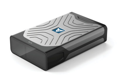
 Innovation finalist, ASTRALiTE for the Bathymetric Lidar System for UAS
Bathymetric lidar from an unmanned aircraft system has been a challenging technology to develop and commercialize. While a few companies have developed a single pulse bathymetric lidar, ASTRALiTe has recently developed first scanning topo-bathymetric lidar system. This is a significant advance on prior unmanned, and manned aircraft-based systems. This milestone demonstrated a more versatile scanning instrument that enables 2-D imagery of the underwater scene, and yet meets the size, weight and power requirements for UAS deployment. The ASTRALiTe lidar provides highly accurate measurements of water depth with 1-centimeter depth resolution. This 1-cm depth resolution means the technology can be used to image shallow water as well as deeper waters. It also means the transition from land to water can be measured and identified accurately. ASTRALiTe’s scanning lidar capability can be used for both small scale and larger scale survey and mapping projects of streams, rivers, ponds, lakes, and coastal environments. This advancement over prior technologies enables new applications in underwater infrastructure inspection, military logistics, natural disaster assessment and recovery, risk assessment for industrial retention ponds, and water resource management.
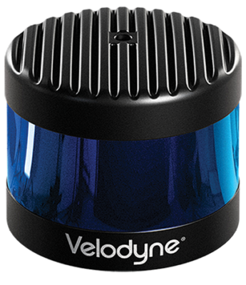 Innovation finalist, Velodyne LiDAR for the VLS 128
Velodyne LiDAR’s VLS-128 sensor was designed to fulfill the requirements of both traditional automotive industry OEMs and new technology entrants. Their requirements include a high-performance sensor that can be produced in volumes and at the scale needed by the auto industry. Introduced in March 2018, Velodyne LiDAR’s VLS-128 is featured on Voyage’s autonomous vehicles in use at retirement communities in California and Florida. The senior citizen population is seen as one of the early adopters and greatest beneficiaries from autonomous driving that provides them safe mobility on demand. The VLS-128 sensor will soon be seen on a range of other deployments in Europe, North America, Japan and China. Lidar sensors are required for safe autonomous driving because they provide the precision perception capabilities that enhance a vehicle’s ability to see in ways that other types of sensors cannot. For fully autonomous driving, you need a vehicle to perceive the world around it in all conditions with a fine level of granularity. For highway driving, the vehicle needs to see far away. The VLS-128 provides real-time 3D data up to 0.1-degree vertical and horizontal resolution with up to 300-meter range and 360° surround view. The VLS-128 provides the range, resolution and accuracy required by the most advanced autonomous vehicle programs in the world. It achieves the longest range, highest resolution and widest field of view—the trifecta of lidar specifications.
Outstanding University Achievement in Lidar
 WINNER of the 2019 LIDAR Leader Award for University Achievement (Most Commercially Feasible) AND People’s Choice Award (University):
Hasso Plattner Institute
Today, landscapes, cities, and infrastructure networks are commonly captured using lidar or image-based remote sensing technologies at regular intervals. The resulting 3D point clouds are digital twins of the captured surfaces and provide valuable information. Consequently, 3D point clouds have become essential for a growing number of applications, such as urban planning, environmental monitoring, and disaster management. The data acquisition workflow itself, whether by air (e.g., plane, helicopter, UAV), sea (e.g., boat), or land (e.g., car, train, stationary scanners) is well established and generates highly detailed 3D point clouds with several terabytes of data. However, the management, analysis and presentation of those data sets still pose challenges because existing GIS are often limited by processing strategies and storage capabilities that generally do not scale for massive 3D point clouds. We present a web portal designed to manage, analyze, and distribute large-scale 3D point clouds. It provides efficient means for an interactive and collaborative exploration and inspection on client devices with different computing capabilities. Point-based rendering techniques and post-processing effects are provided to enable task-specific and data-specific filtering and highlighting. A set of interaction techniques allows users to collaboratively work with the data, e.g., by measuring, annotating, or triggering analytics tasks for arbitrary data subsets. These tasks include for example: (1) Classification and change detection for urban areas captured with airborne lidar or image-matching. (2) Classification and asset detection for 3D point clouds from mobile mapping. (3) Analytics for 3D point clouds from UAVs to monitor vegetation and construction sites.
 University of HoustonWINNER of the 2019 LIDAR Leader Award for University Achievement – Most Innovative Use
Andrea Albright (measuring breaking waves with lidar)
The NCALM (National Center for Airborne Laser Mapping) is based at the University of Houston and is operated in partnership with the University of California, Berkeley. The center is supported by the National Science Foundation and is associated with the multi-disciplinary Geosensing Systems Engineering & Sciences graduate program at the University of Houston. The mission of NCALM is to:
- Provide research-quality airborne light detection and ranging (lidar) observations to the scientific community.
- Advance the state of the art in airborne laser mapping.
- Train and educate graduate students with knowledge of airborne mapping to meet the needs of academic institutions, government agencies, and private industry.
Additional universities that were considered during this year’s process:
 Ferris State University
The Surveying Program at Ferris State University was established in 1958. It is the largest undergraduate Surveying engineering program in the Midwest and one of the largest in the U.S. The program offers the following: BS in Surveying Engineering, AAS in Surveying Technology, and certificates in Surveying, GIS, and Hydrographic mapping. The Bachelor of Science in Surveying Engineering is approved and recognized by the Michigan State Board of Licensing for Professional Surveyors and is also accredited by ABET. Students graduating from the bachelor’s program after appropriate work experience are eligible to take the professional surveyor and the professional engineer examinations. The Surveying Engineering Department has educated surveyors for more than fifty years and has provided diverse employment opportunities with large and small private surveying and mapping firms; federal, state and local governmental agencies globally. The program offers over $20,000 in annual scholarships.
![]() University of Kentucky
University of Kentucky
Many safety hazards on our roadways that cause accidents are often imperceptible and difficult to measure. The Kentucky Transportation Center at the University of Kentucky has discovered several innovative applications for using mobile lidar to mitigate such highway safety hazards. One such application has been in evaluating areas known for accidents during wet weather events. According to data from the Kentucky State Police crash database, 20% of all highway accidents in the past 5 years occurred during wet weather events and over 1800 accidents cited “water standing or moving” as a contributing factor. “Water standing or moving” can be deciphered as an area where the pavement design is inadequate during intense rainfall events, which may create conditions known to cause hydroplaning. Through the use of our mobile mapping system we are able to re-create a highly detailed roadway surface allowing us to analyze slope and drainage patterns that could be problematic for vehicles during such rainfall events. Another application of mobile lidar to improve highway safety has been in locating and quantifying lane differential settlement on concrete pavements. Substantial lane differential settlement poses a hazard to vehicles, and particularly to motorcyclists, when changing lanes. A scan of the affected roadway with our mobile mapping system, along with our innovative processing techniques, allows us to isolate these areas of differential settlement and provide the location and approximate quantities of settlement to assist in remediation efforts.
 University of Maryland, College Park
University of Maryland’s Master of Professional Studies & Graduate Certificate Programs in GIS and Geospatial Intelligence are dedicated to providing the most up-to-date training on geospatial technology, theory, and applications.