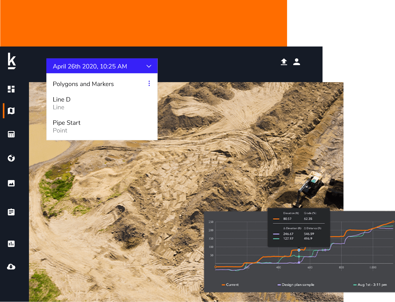
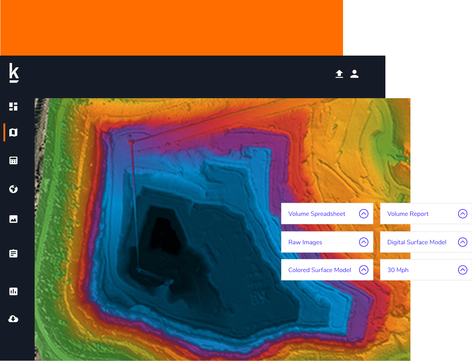
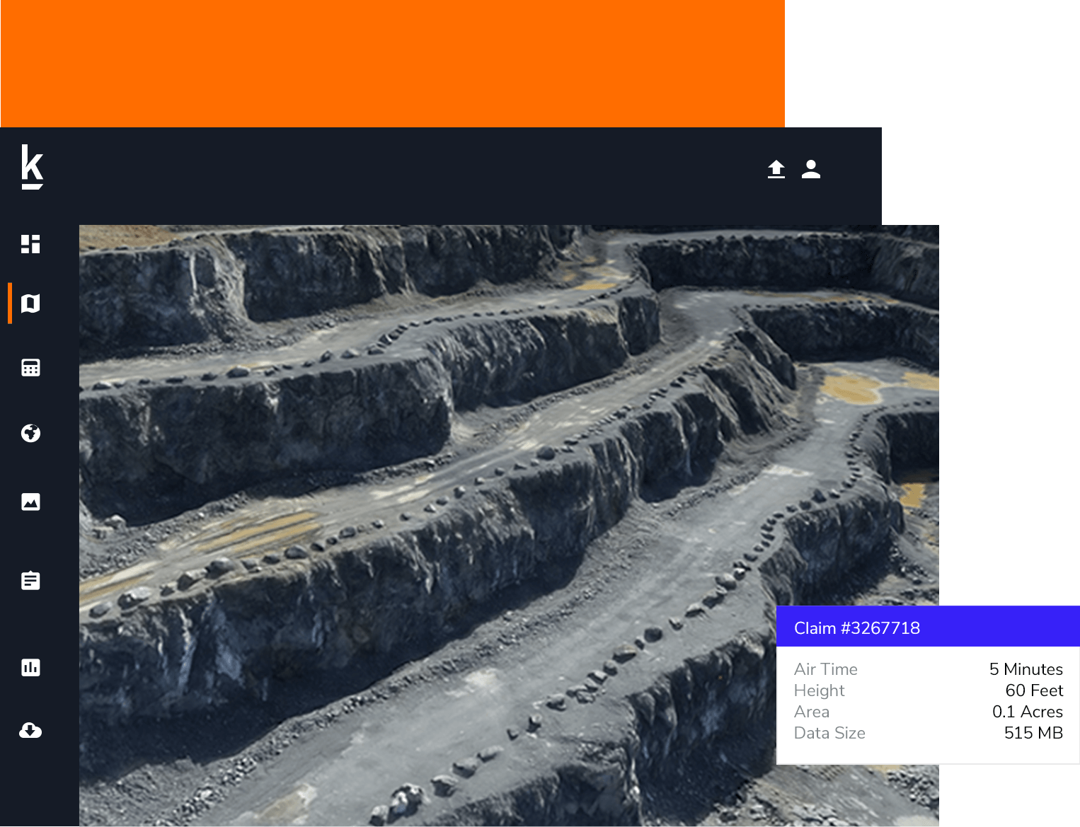
Accurate Mine Planning And Site Operations

Mine engineers, surveyors, and project managers deploy Kespry to survey active mining operations, reduce third-party costs, eliminate delays in project schedules, and ensure mine plans are properly executed.

Survey-Grade Drone Data for Mine Planning

Mine Planning
Using Kespry for Mine Planning enables engineers and surveyors to —

  • Produce accurate plans faster for pits, haul roads and mine reclamation
  • Deliver more efficient and safer project operations
  • Ensure compliance of mine plans and validate reserve models

Read our whitepaper, 3 Ways To Improve Mine Planning With Drone Data

Learn More

Capabilities

Capabilities

Stockpile Measurement

Managers have immediate access to current earthwork activity without waiting for data turnaround or tasking engineering teams or third-party services.

  • Manage cut-and-fill quantities from one dataset to another and improve earthwork operational efficiencies
  • Directly upload design surfaces to track progress on worked per formed
  • Automatically generate elevation profile across active operations and compare data from one flight to another or a design file to better track progress

Watch our on-demand webinar “Lehigh Hanson Uses Drones For Mining Operations” to learn more.

Download

Mine Planning and Reserve Modeling

Frequent flights enable mine planners to update and manage to mine plans on an as-needed basis.

  • Produce a complete survey-grade topographic map for quick assessments of drainage patterns, tailings conditions, and in-site geologic conditions
  • Standardized data enables teams to perform analysis and prepare for drilling operations, environmental studies, and geologic investigations
  • Export data in multiple formats (points, contours, point clouds, GeoTiff, DXF, etc.) to third-party design software and update and develop mine plans

Compliance and Safety

Autonomous drone flights without setting multiple Ground Control Points (GCPs) and automated slope detection improves worker safety and ensures mine compliance.

  • Set thresholds for minimum berm heights, required haul road widths, and max slope angles to receive automatic alerts and correct issues
  • Fly from a single location without having to set control points and fly over active operations
  • Evaluate highwalls, benches, and stockpiles from the safety of an office

Customers

Customers

The Kespry Drone System has been easy for us to deploy to help manage our mine operations and stockpiles. We’re excited about putting Kespry drones to work at our mines.

Jon Layne

Business Development Manager, Sully-Miller

We like to do our mine planning visually with the photos. And with the contours, we were able to look at our contours to keep everything straight and calculate projected volumes for our future blasting.

Ken Kampman

Survey and Operations Manager, Fred Weber

Request a Demo

Ready to see how Kespry’s drone-based Aerial Intelligence platform enables you to rapidly and accurately survey and analyze stockpile inventories, comprehensively track large-scale worksites across industries, and inspect residential and commercial rooftops? Request a demo now and we’ll show you how our platform can work for you.

Request Demo